Insurance 'reform' hits home in Onset
Nicole Thomassen of Onset feels like the poster child for everything that has gone wrong with the country's flood insurance program.
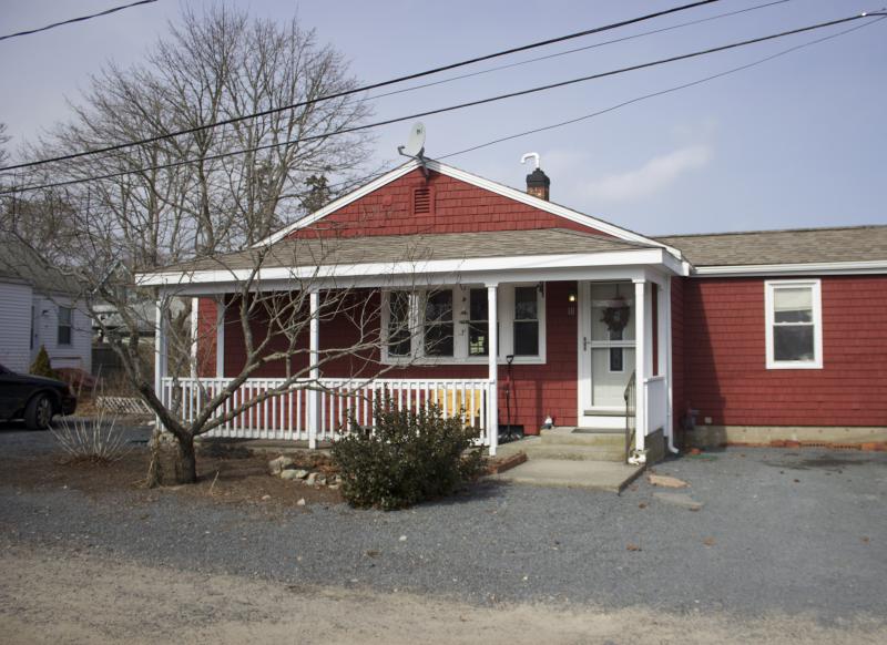
When she and her fiance moved into her Evergreen Street home in March of 2013, she knew she would have to pay $1,600 annually for flood insurance. Located in a flood zone but constructed before building codes required such homes to be elevated and otherwise protected against flood damage, the $150,000 house was not eligible for a mortgage without flood insurance.
But they didn't yet know what would happen when Congress changed the rules on flood insurance. With her policy up for renewal in January, Thomassen was told her house was in a higher risk zone. Without the previous federal subsidies, she was told her annual premium would be $24,000.
“The simple fact is that we cannot afford this. No way. No how,” she said.
While Congress scrambles to revise Biggert-Waters Act that sent insurance rates skyrocketing, Thomassen, other homeowners, prospective homebuyers, Realtors, insurance agents and mortgage brokers are seeing the predicted effects of the act on coastal communities such as Wareham.
With the National Flood Insurance Program $24 billion in debt after delivering payouts from a surging number of hurricanes and super storms, the Biggert-Waters Act was passed in 2012 to rein in the taxpayer cost of the flood insurance program.
The Act dropped two key provisions that kept premium rates low: Flood insurance was no longer subsidized by tax dollars for homes that pre-date the flood insurance program, and homes that met flood-zone requirements when they were built, but have since been placed in a higher risk flood zone, were no longer “grandfathered” in to previous insurance rates.
In addition to that, Federal Emergency Management Agency was in the middle of redrawing its floodmaps, defining which homes were in flood-prone areas.
While congresspeople knew rates would rise, the speed and size of the increase came as a surprise to most legislators.
“I've made calls where the insurance has gone up to $46,000,” said David Dunn of G.H Dunn Insurance Agency. “If you're saying it costs $46,000 a year to insure a $230,000 home, you're telling me the house is going to be wiped out every five years. That doesn't sound like the true cost.”
Dunn said he's had countless people who have wanted to purchase houses but had to walk away due to flood insurance. For example, he told of a new Wareham schoolteacher who found a house in the area and was about to be a first time homeowner until the flood insurance estimate was $10,000 per year and she had to walk away.
"She lost her dream house," Dunn said.
In Thomassen's case, she already owned the house when told by her insurance broker that she needed to purchase an elevation certificate provided by a civil engineer measuring the property's precise elevation above sea level. Any home bought after July 2012 or being sold in an existing high risk flood area needs an elevation certificate.
After spending $600 for the certificate, her annual flood insurance rate became 15 times more expensive and ballooned to $24,000 a year.
Thomassen said her neighbors told her the only time in the last 25 years they had even the slightest flooding was during Hurricane Bob in 1991.
After pursuing her insurance agent and the engineer — who conceded he improperly mapped her property — she was properly placed in a more realistic flood zone at a still unaffordable rate of $7,500.
The Senate passed a bill last Thursday set to scale back many of the flood insurance premium hikes, such as capping premium increases at 18 percent annually and allowing homeowners to "grandfather" buyers by passing on their below-market rates in flood zone areas. The legislation passed both houses of congress and is set to be signed by the president.
But according to Rep. William Keating, the government still has to address the fundamental problems with the flood maps.
Last November, Keating requested a study on the maps from scientists and engineers with UMass Dartmouth. The study found that the maps used flood models for the Pacific coast that had no bearing on flooding on the Atlantic coast.
“They were using the wrong science,"”as Keating put it.
This study led to the delay of the map implementation in the northern parts of Plymouth County by at least a year. But the southern parts of the county, where the maps have already been enacted, won't be so lucky.
“The maps should be repealed across the entire state,” Keating said.
The impending legislation should bring relief to many in coastal communities but it's unclear what its long term effect will be.
“Is this going to be a temporary band-aid or a long term solution?” asked Geoff Worrell of Prospect Mortgage. “It's hard to tell exactly what's going to happen.”
Worrell said according to the National Association of Realtors, since implementation of the Biggert-Waters Act, 40,000 home sales were either delayed or cancelled due to flood insurance.
He said a lot of first time buyers will decide to not even look at homes in a flood zone.
“A home is the biggest investment people are going to make in their lives,” Worrell said.
Thomassen has spoken to her mortgage company and for the time being is allowed to pay her insurance at her previous rate, but doesn't know how much longer that will last.
“This was supposed to be a starter home,” she said. “I refuse to lose my home because properties too close to the shore continue to be damaged.”


