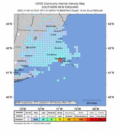
Yes, that was an earthquake
A magnitude 3.6 earthquake shook Wareham at about 9:10 a.m. on Sunday, Nov. 8, U.S. Geological Survey data confirms.
People felt the earth shake as far away as Cape Cod, Connecticut and parts of southern New Hampshire. Wareham and Onset residents quickly took to social media after the quake, describing shakes and tremors they felt at home in neighborhoods around town and near community landmarks such as the Gleason Family YMCA.
Internet users who felt the earthquake in Wareham reported primarily light shaking and no damage to the USGS.
The quake originated in Buzzards Bay just offshore of Dartmouth and was recorded at 15.1 kilometers — or about 9.3 miles — deep at 41.526°N 70.966°W.
New England is not commonly known for seismic activity, but this is not the first earthquake to shake the state of Massachusetts. The last earthquake in felt Massachusetts, a 2.1 magnitude quake, was recorded four months ago in Osterville, according to Earthquake Track’s website.
The largest earthquake in the state’s history was a quake off Cape Ann in 1755. Its magnitude was estimated to be about 6.2.
The quake was first reported as an earthquake with a magnitude between 4.0 and 4.2, but that has since been changed.
“The USGS often updates an earthquake's magnitude in the hours and sometimes days following the event,” reads the USGS website. “Updates occur as more data become available for analysis and more time-intensive analysis is performed.”


