As sea levels rise, Wareham is at higher flood risk
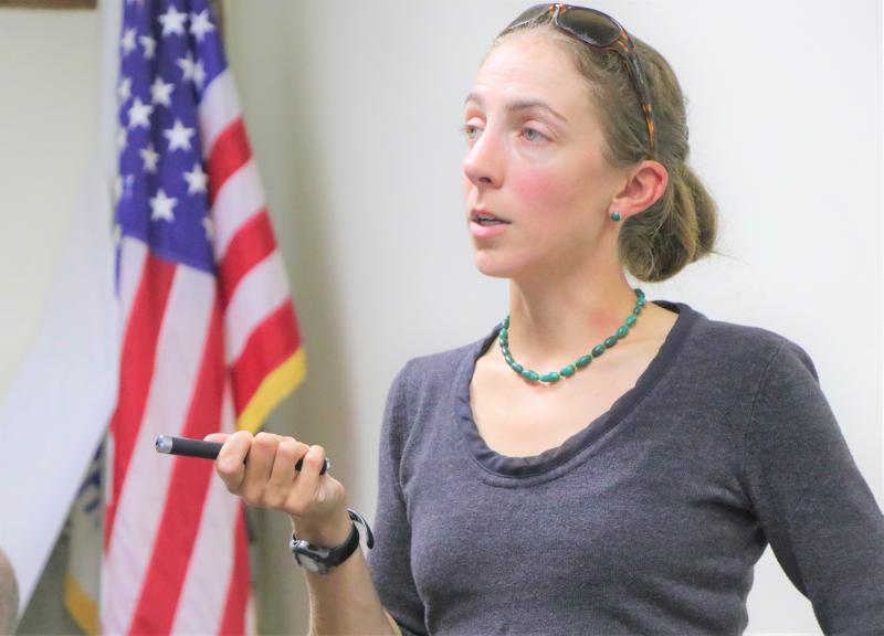
Warming seas and melting sea ice are causing sea levels to rise, and putting Wareham coastal homes and infrastructure at increasing risk of chronic flooding. Elise Leduc, a coastal scientist from the Woods Hole Group, presented a first look at what roads and structures are vulnerable to damage during a major storm at a public event on Thursday, September 26.
Places like Harbormaster Building, Main Street, Narrows Sewer Pump Stations, the Wareham Fire District Fire Department, and many other town-owned infrastructures could be flooding in the coming 50 years, said the coastal scientist, noting that 2030 changes are not as drastic as the ones projected for 2070, but that areas that can expect water from a big storm will change from where they are today.
“Things are changing. As the earth’s atmosphere heats up, it also heats up the earth’s oceans. Sea surface temperature changes from the historical average. It is warmer than it used to be. It might seem like a small change of one or three degrees Fahrenheit, but it makes a big difference if you think about how water expands when it’s warmer and contracts when it’s colder,” said Leduc. “Just ocean expansion itself can lead to a sea-level rise.”
The presentation was based on the results of “Municipal Vulnerability Preparedness,” a study by the Woods Hole Group on Wareham’s vulnerability to climate change. The study was largely funded by Gov. Charlie Baker’s MVP grant program, which was designed to help Massachusetts’ coastal communities prepare for the impacts that rising tides are having on infrastructure, neighborhoods, and roadways.
Leduc looked at the potential for flooding in Wareham’s following significant storms today, in 2030, and in 2070.
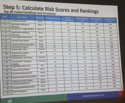
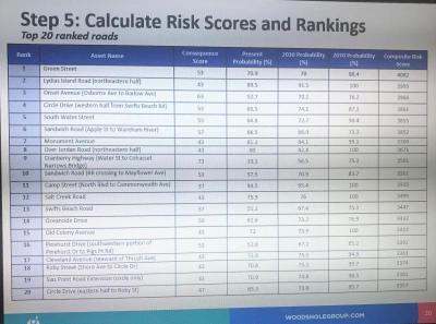
The group assigned a composite risk score to the town’s roads and assets, which was calculated based on the property’s flood risk and the severity of the consequences from a flood, such as impacts on public safety and emergency services.
The most vulnerable street is Green Street in Onset. Other vulnerable roads include Lydias Island Road in Onset, Onset Avenue (from Osborne Avenue to Barlow Avenue), Circle Drive (from Swifts Beach Road going west), South Water Street in Onset, and Sandwich Road (from Apple Street to Wareham River).
The most vulnerable building is Tremont Nail. Given its location and elevation, the Woods Hole Group determined there is a 100 percent chance of flooding at this location under current conditions.
The sewer system is especially vulnerable, according to the coastal scientist.
If a 100-year storm were to happen this year, the floodwater would reach an elevation of 11.7 feet in the area of Hynes Field Pump Station in Onset. If that same storm were to happen in 2070, the floodwater would reach an elevation of 18.7 feet, causing water to almost completely submerge the station.
The final report, which should be completed this year, will recommend strategies such as infrastructure repairs and upgrades, land acquisition and management, and changes to policies and regulations.
“For the next steps, we will develop short, mid and long-term adaptation strategies to address flooding impacts,” said Leduc. “Woods Hole Group will be working with the town to pick through this data and really come up with some of the actionable items that town can do to address the flood risk to the infrastructure.”


